Date: April 15 2022
Location: Brecon Beacons, Wales
Distance: 13.5km
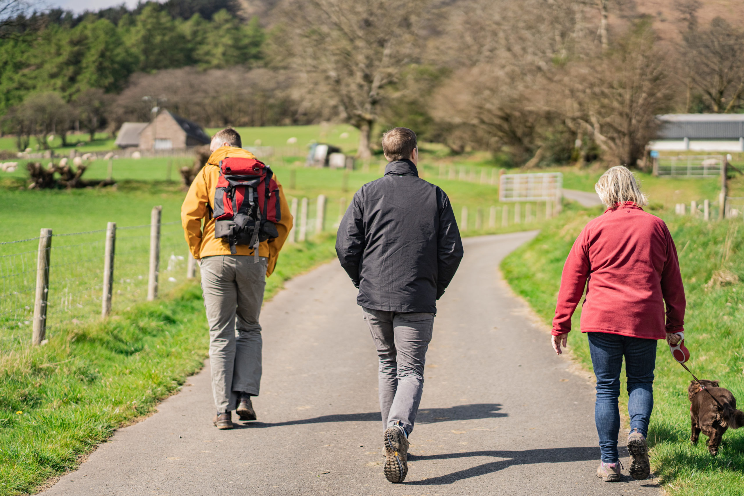
At the end of last year while visiting Wales, we went on a nice walk to some waterfalls near the Talybont Reservoir in the Brecon Beacons National Park. After the walk I was doing some “googling” of the walk and nearby area when I found out there was a nearby hike that leads to a memorial and the remains of a WWII Canadian plane crash. Over the Easter weekend, while visiting Wales, we enjoyed some beautiful weather and made our way to visit this memorial.
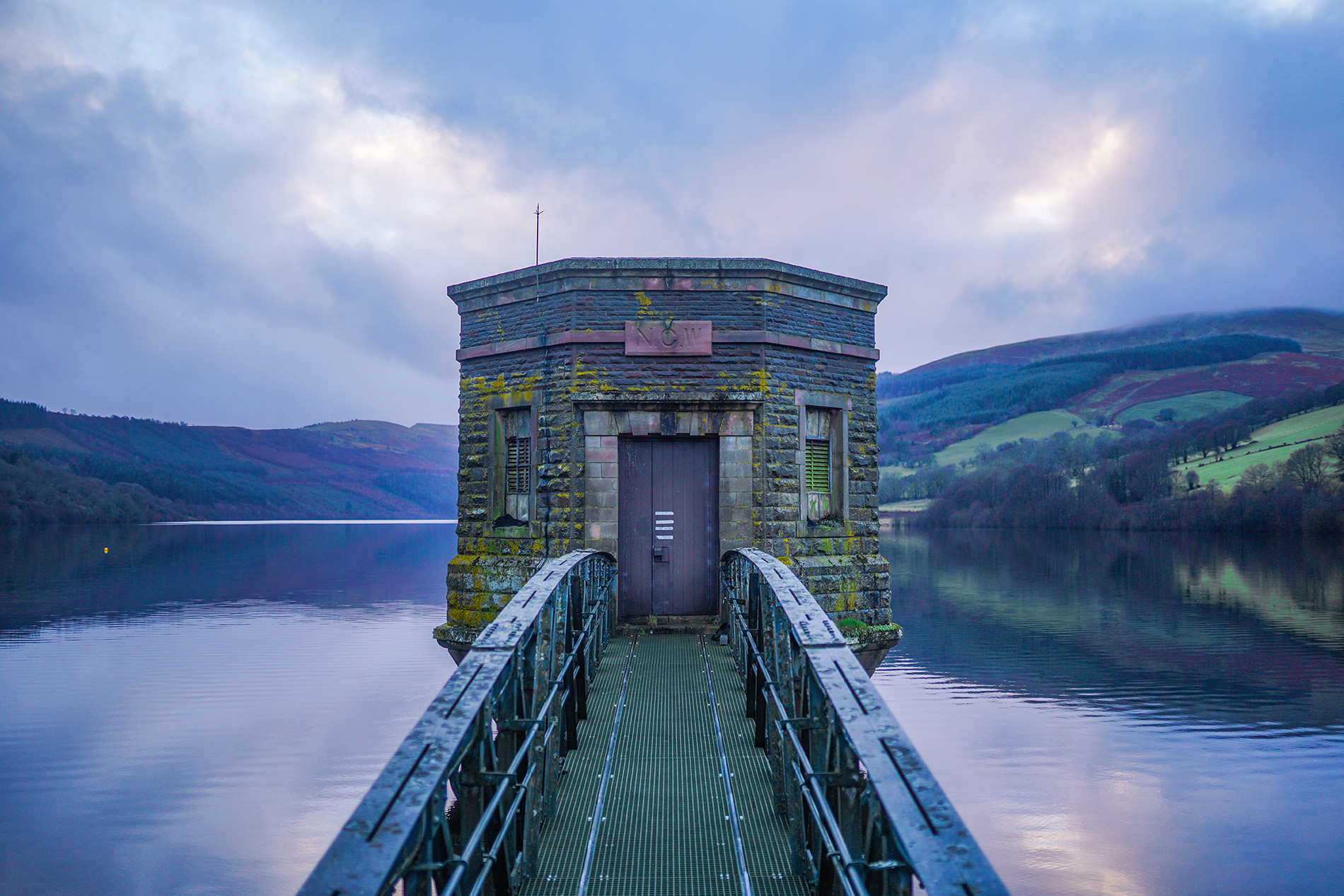
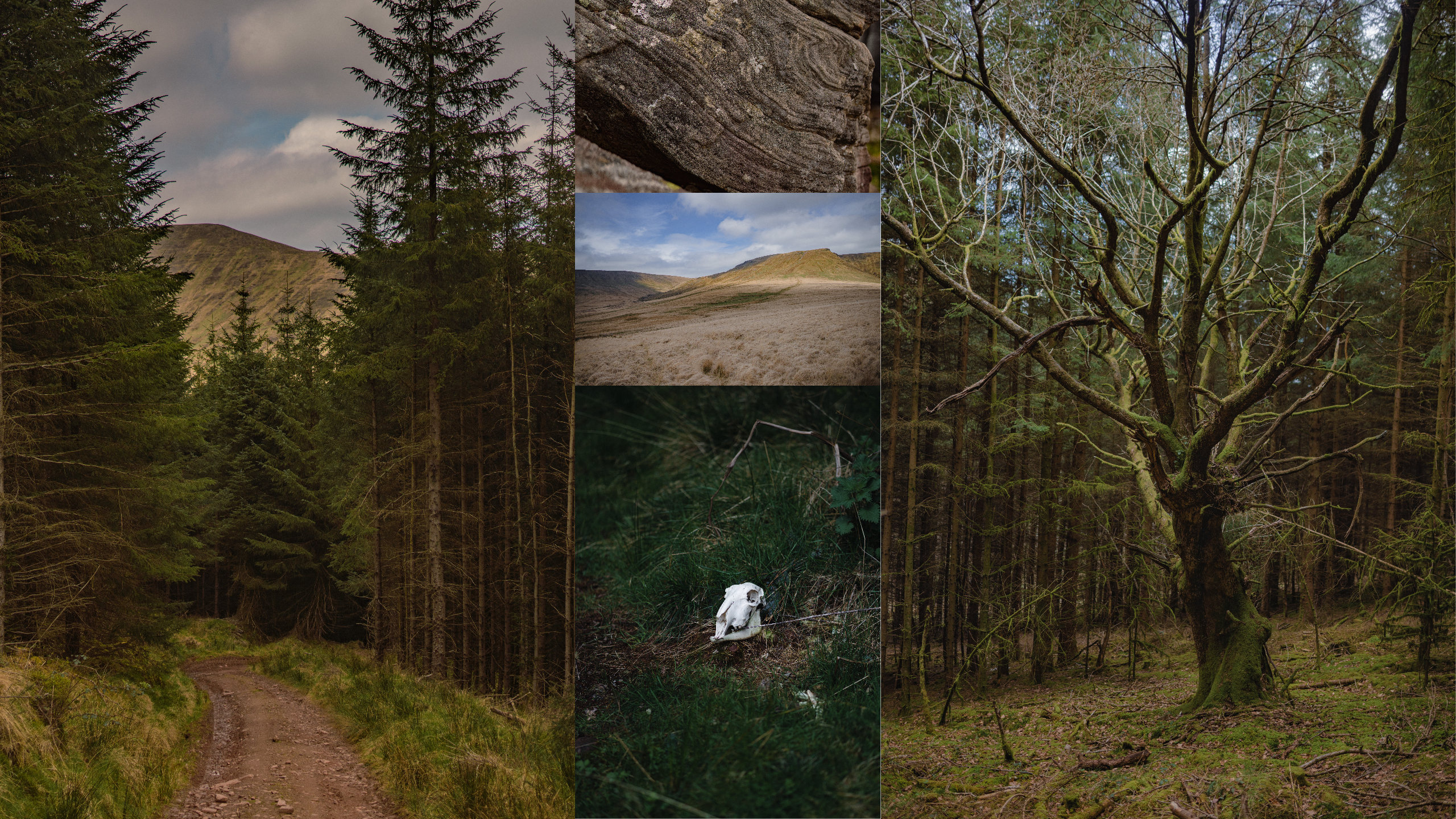
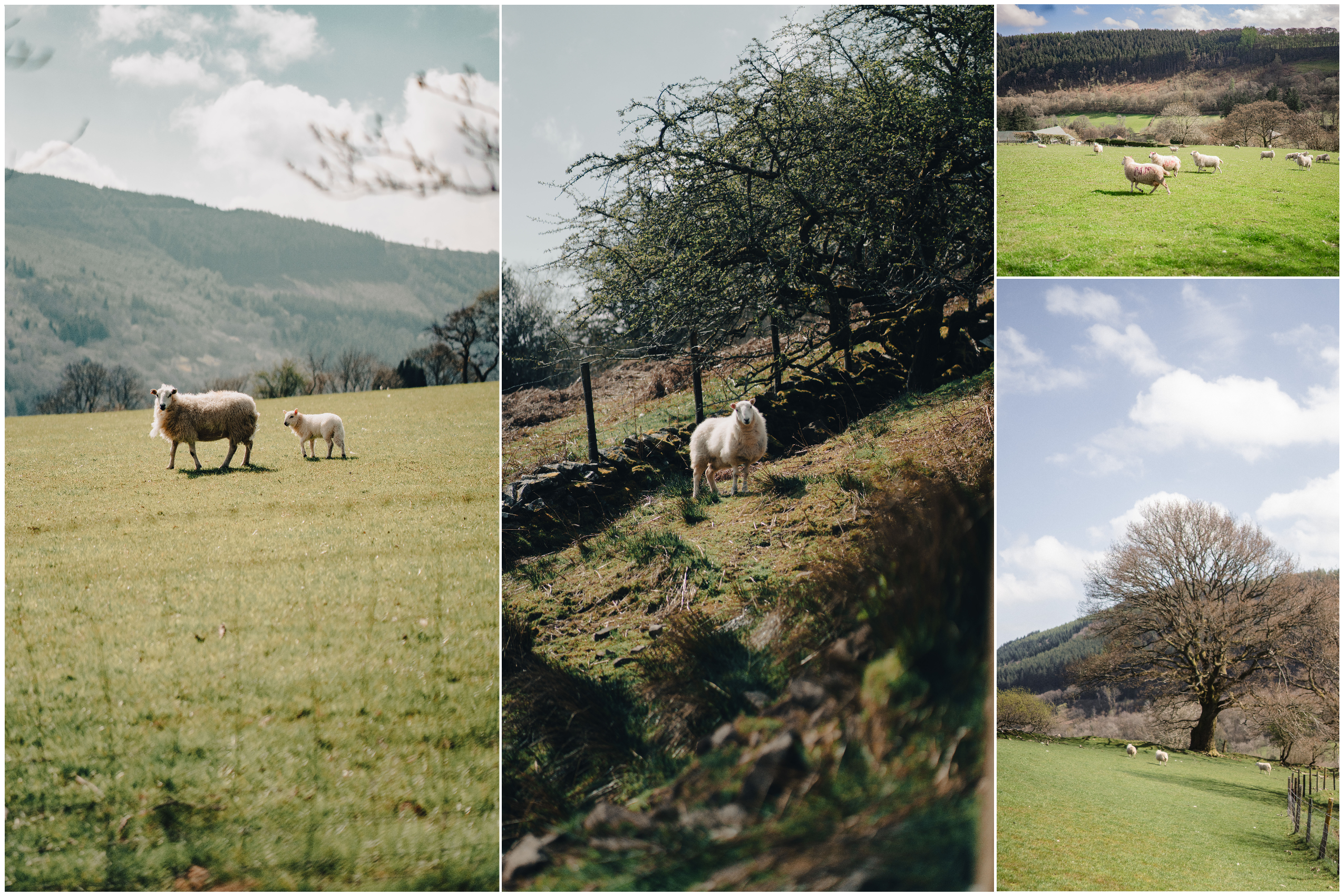
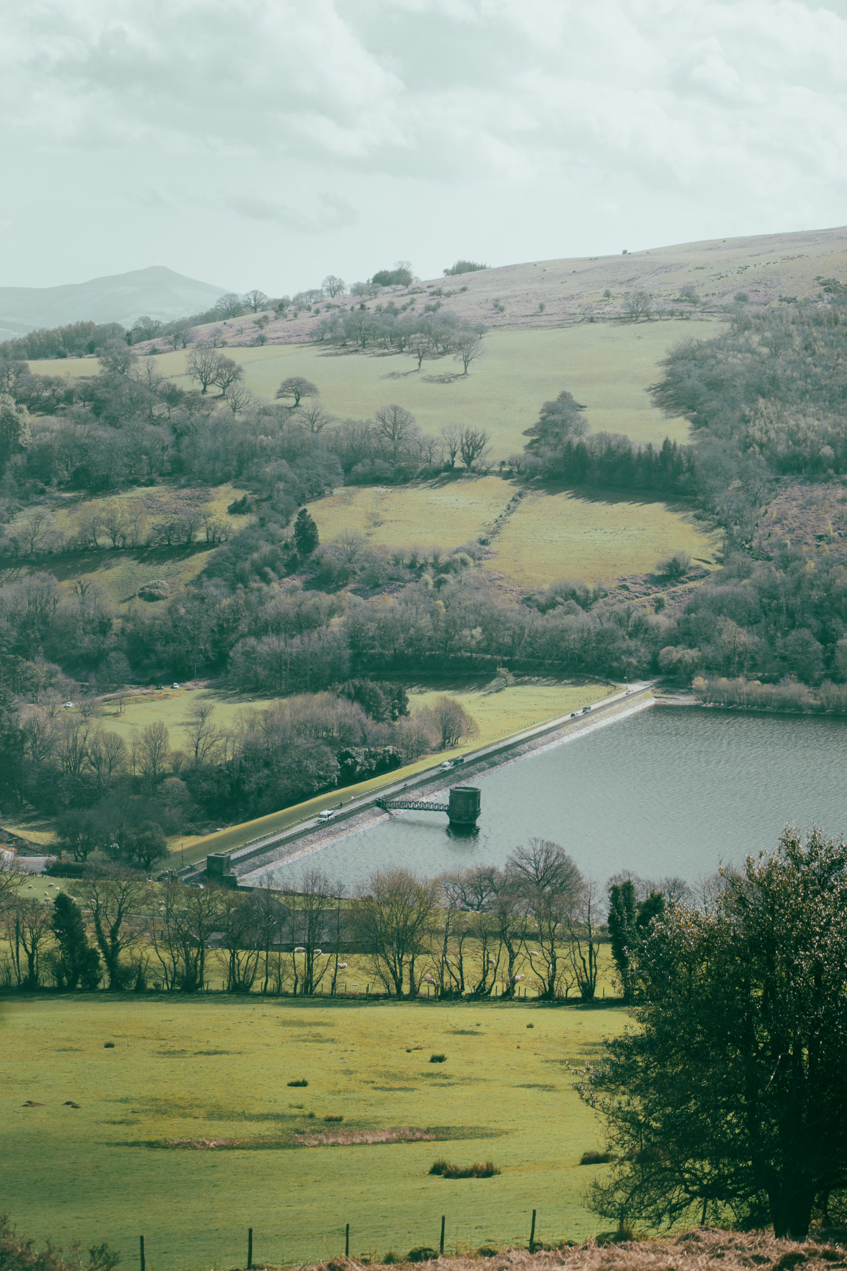
Our walk started near the bridge of the nearby Reservoir, which is a 318 acre lake in the Brecon Beacons. By the time we parked, the road was already quite busy with walkers, cyclists and people heading out on their own adventures. The first part of our walk cut through some sheep farms and we were greeted by a symphony of loud sheep echoing on each side of our path.
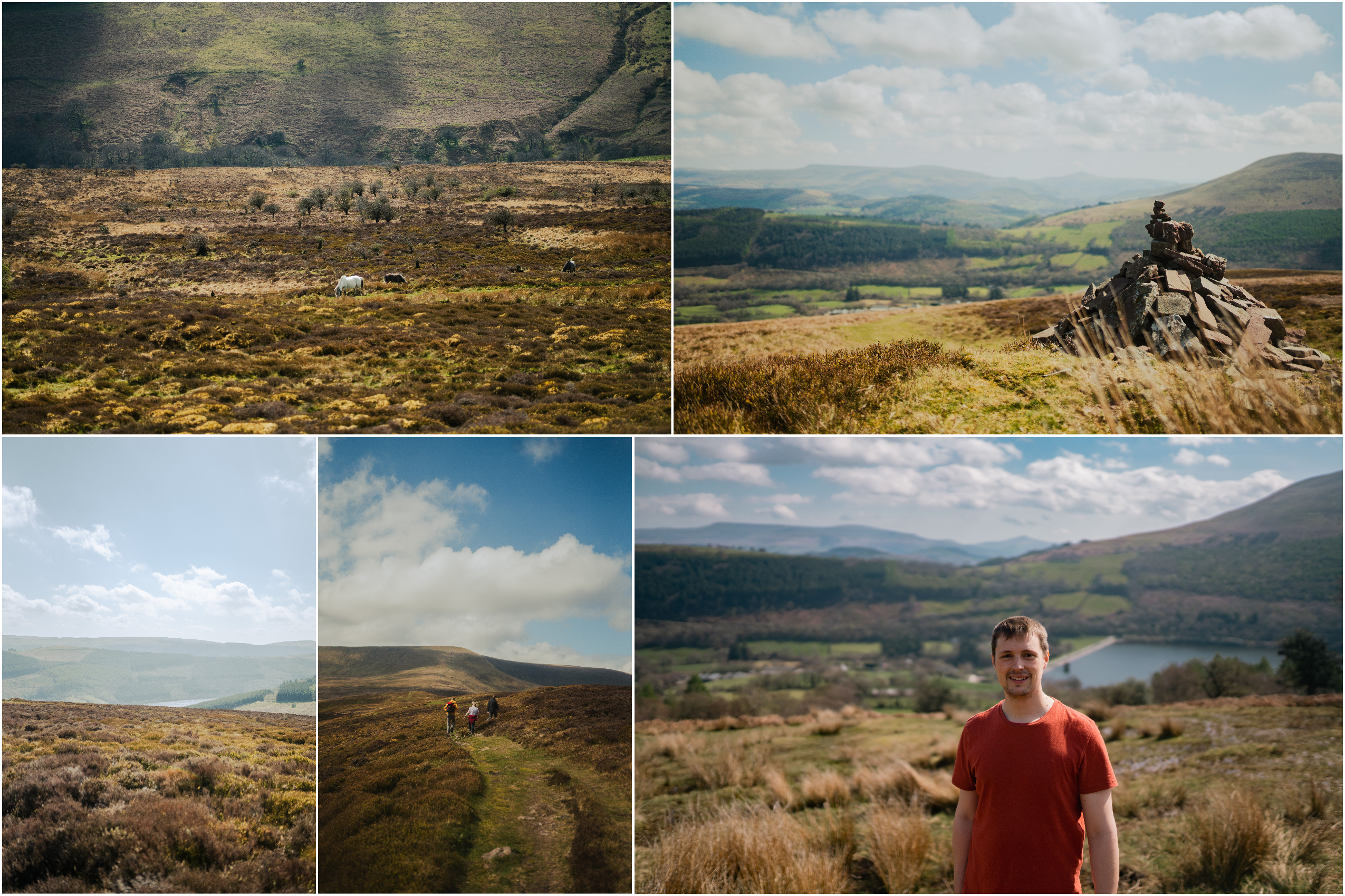
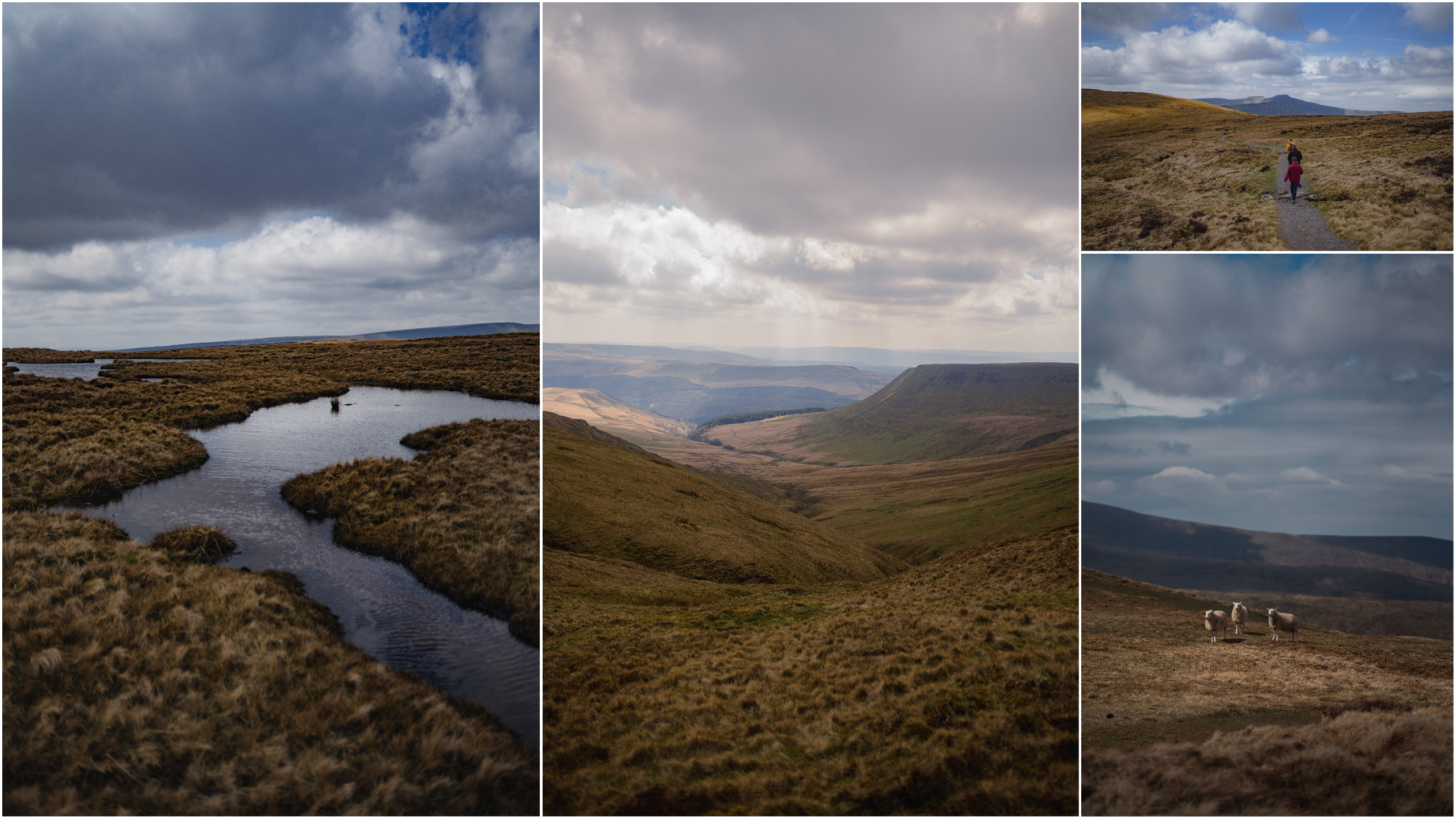
To reach the site of the plane crash memorial we ascended up into the hills surrounding the reservoir, each time I looked back the view expanded, showing the lake nestled inside the rising hills covered in grass.
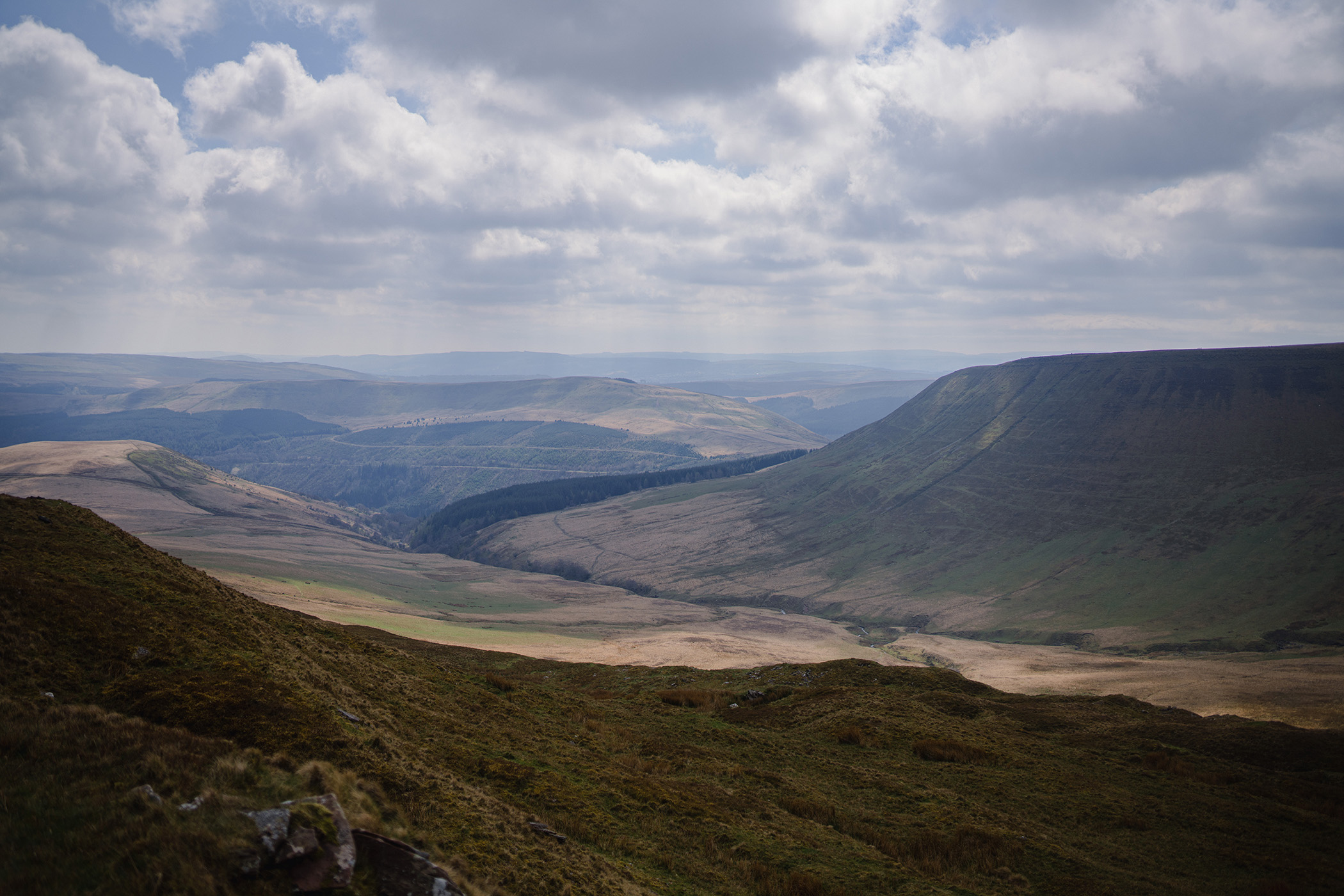
As we continued to climb up the path we were treated to impressive and sweeping views of the countryside, as well as a few wild horses dotting the nearby hillsides.
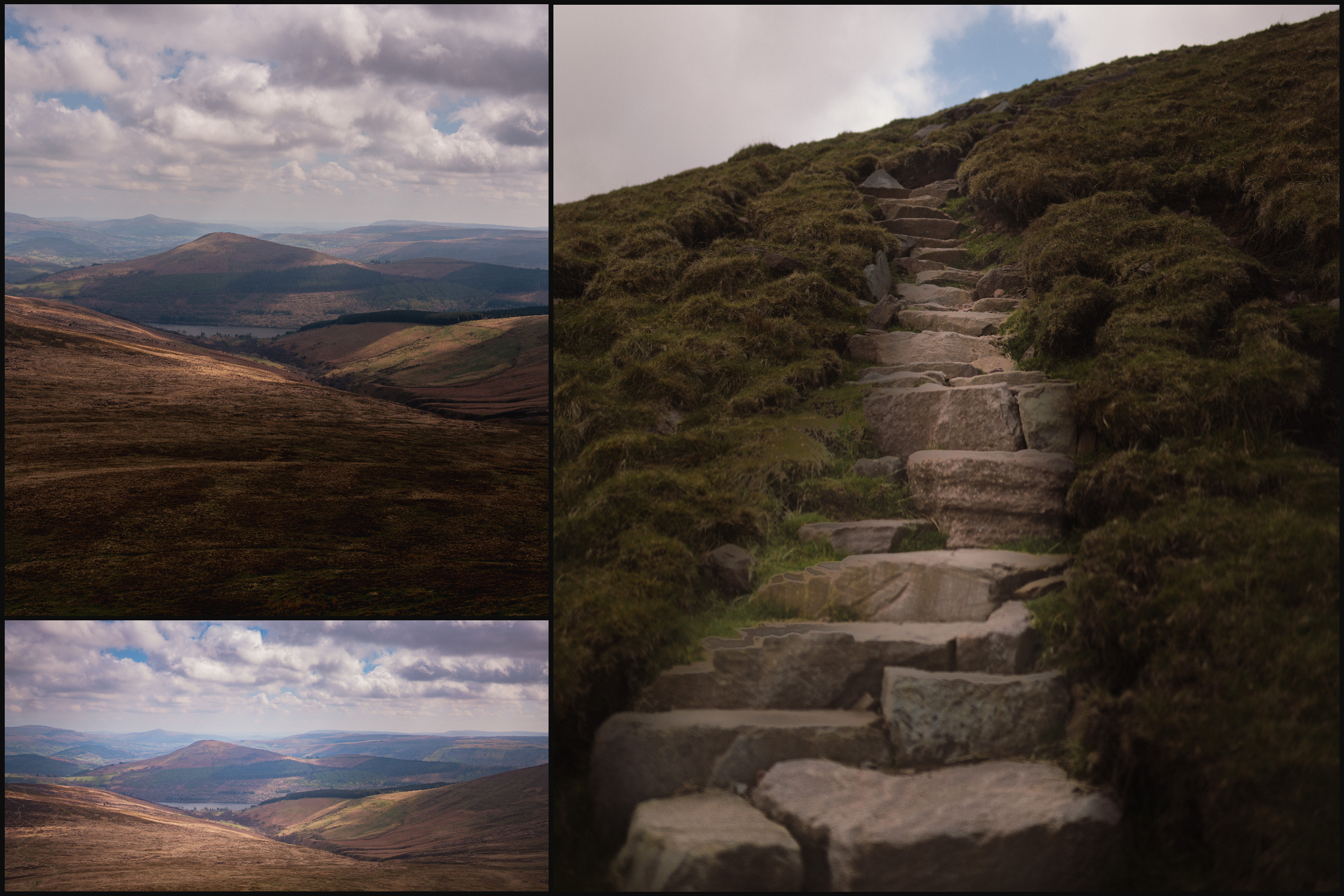
The rise up to the top of the peak, called Carn Pica was continuous and as we approached the last few hundred meters, the trail turned to a stone staircase cut into the hillside, it slowly curved and climbed up, leading to the marshy plateau of the beacons.
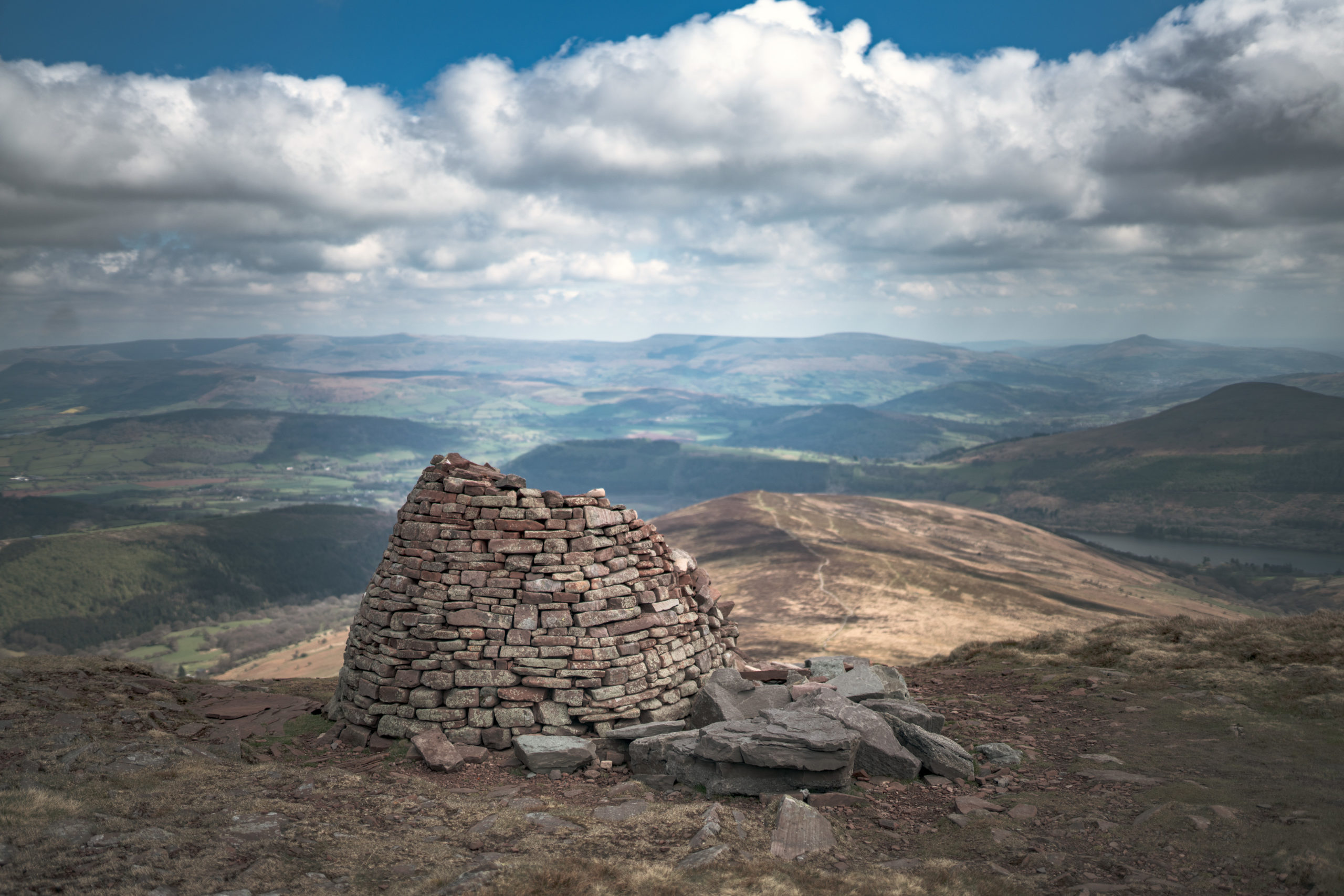
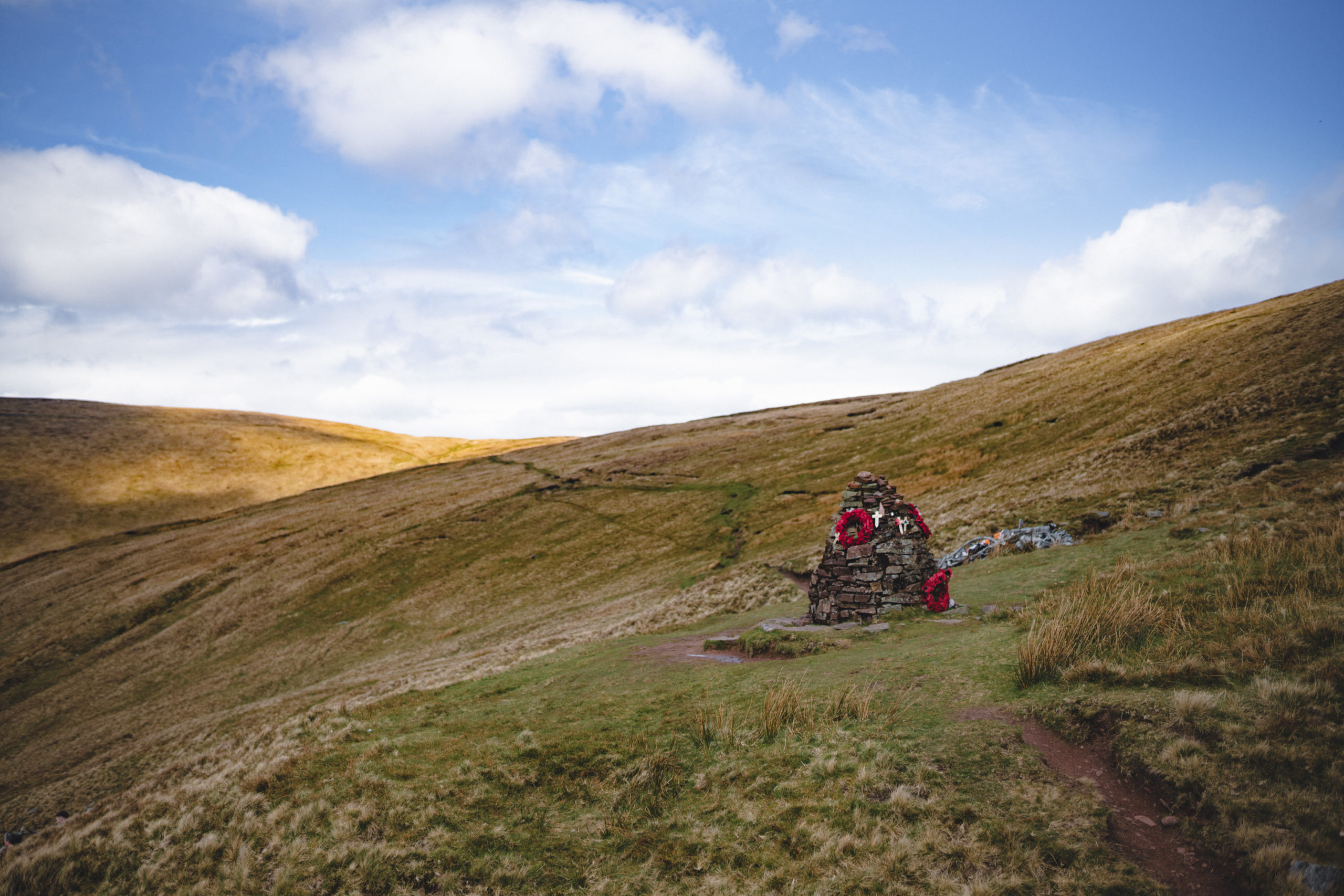
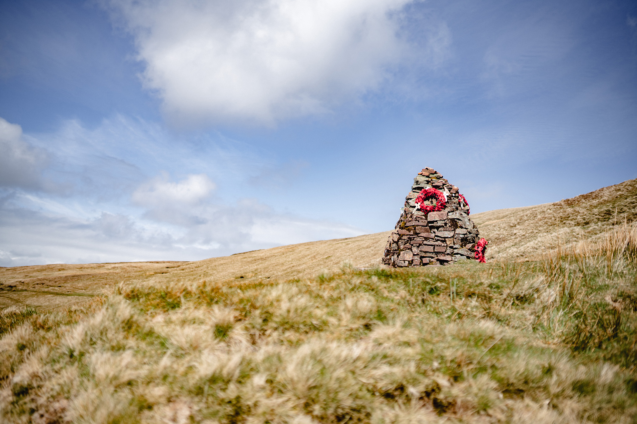
Once at the top of Carn Pica, we were greeted by an impressive beehive style cairn. I couldn’t find much information about the cairn other than that it’s likely a newer one built over top an ancient burial site or marker. I found this spot to be rather impressive, like a soldier looking out over the valley below.
Once we’d reached the top of the plateau, it was a gentle walk for a while as we crossed the flat, marsh filled open space. In the distance we could see Pen Y Fan, the highest peak in southern Wales (and our next walk) as well as the other nearby peaks that make up the Brecon Beacons National Park.
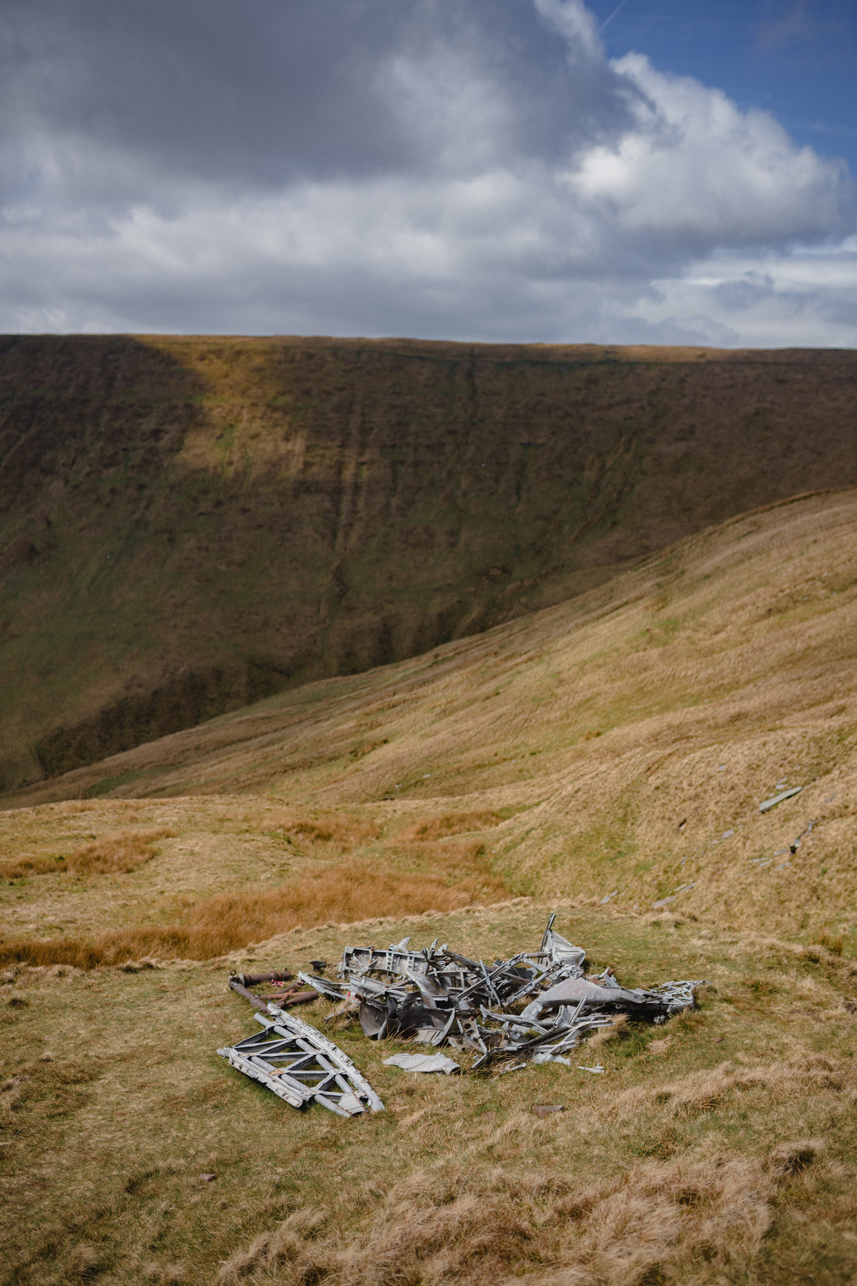
As tempting as it was to follow the ridge and open plateau hugging the wide horseshoe shaped peak, we cut down along a narrow path that gradually declined back into the valley, leading us toward the plane crash memorial site.
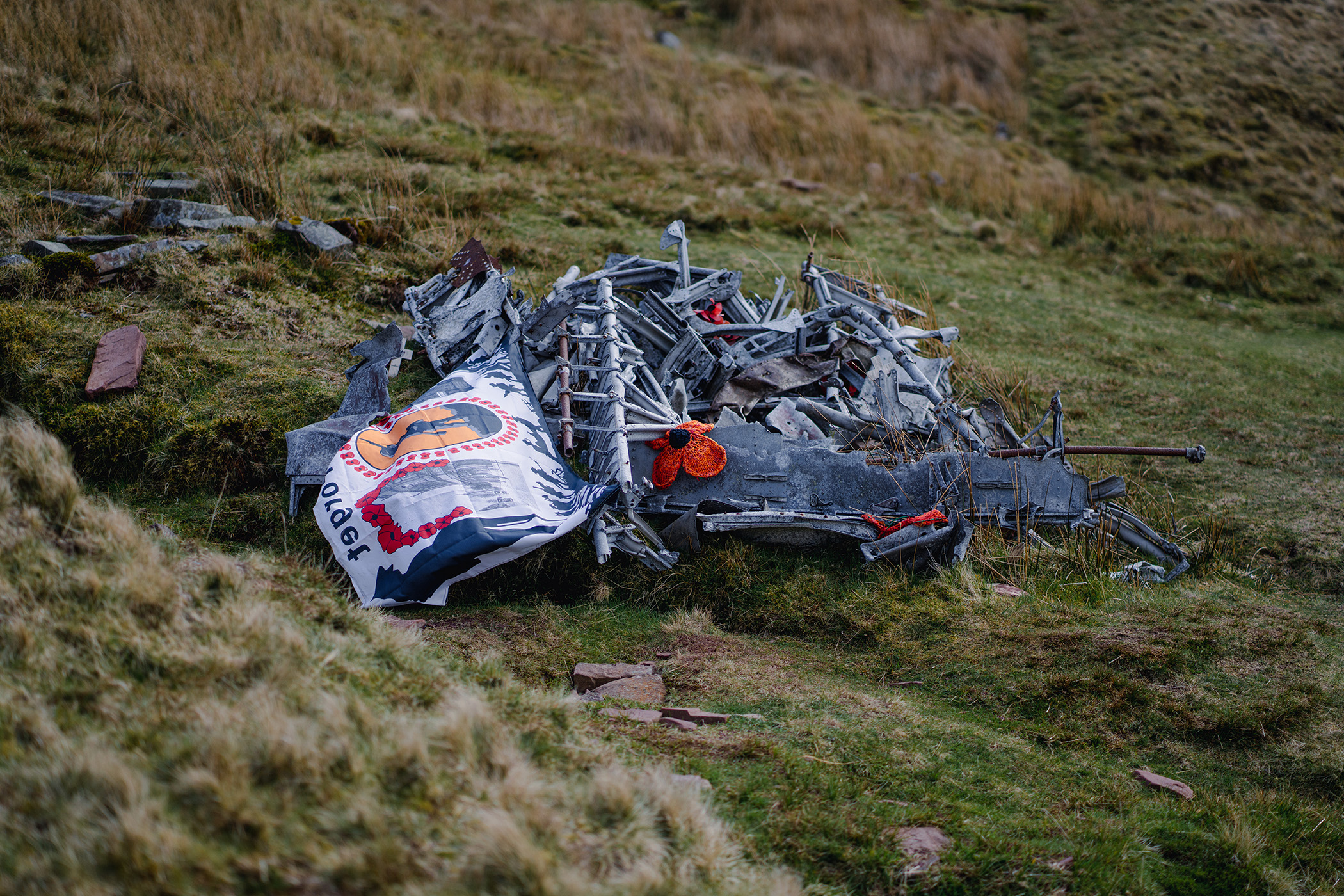
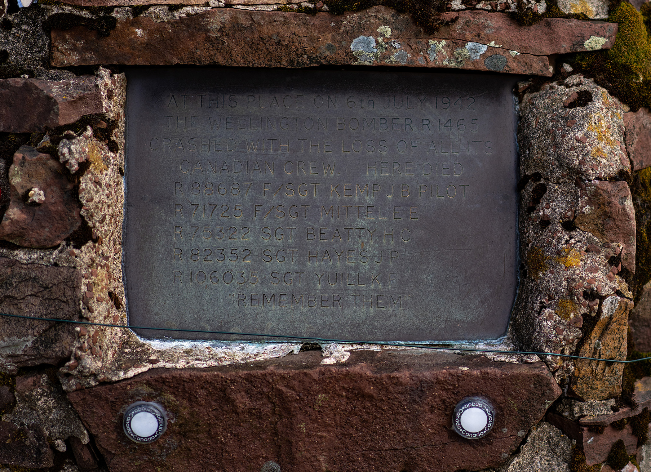
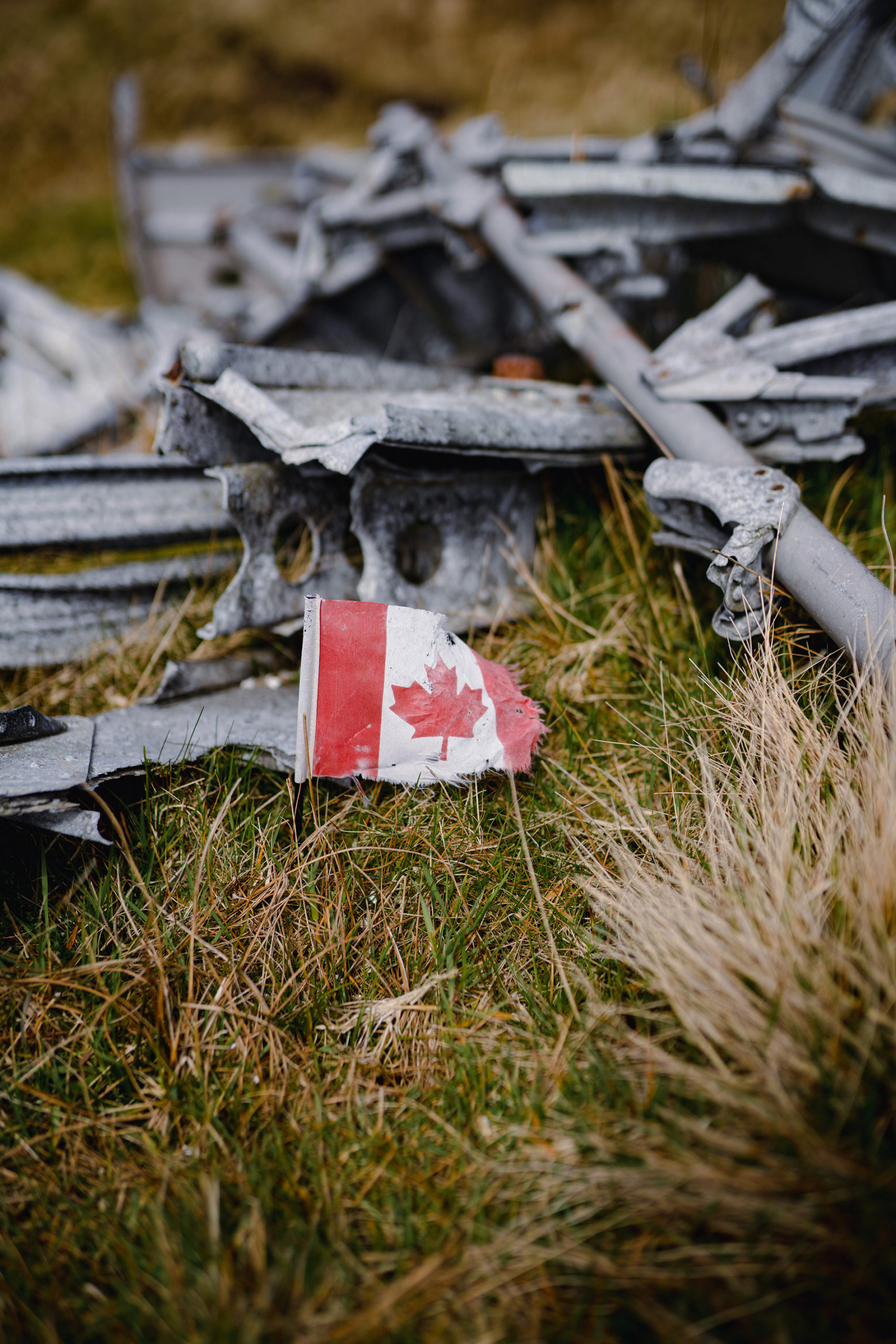
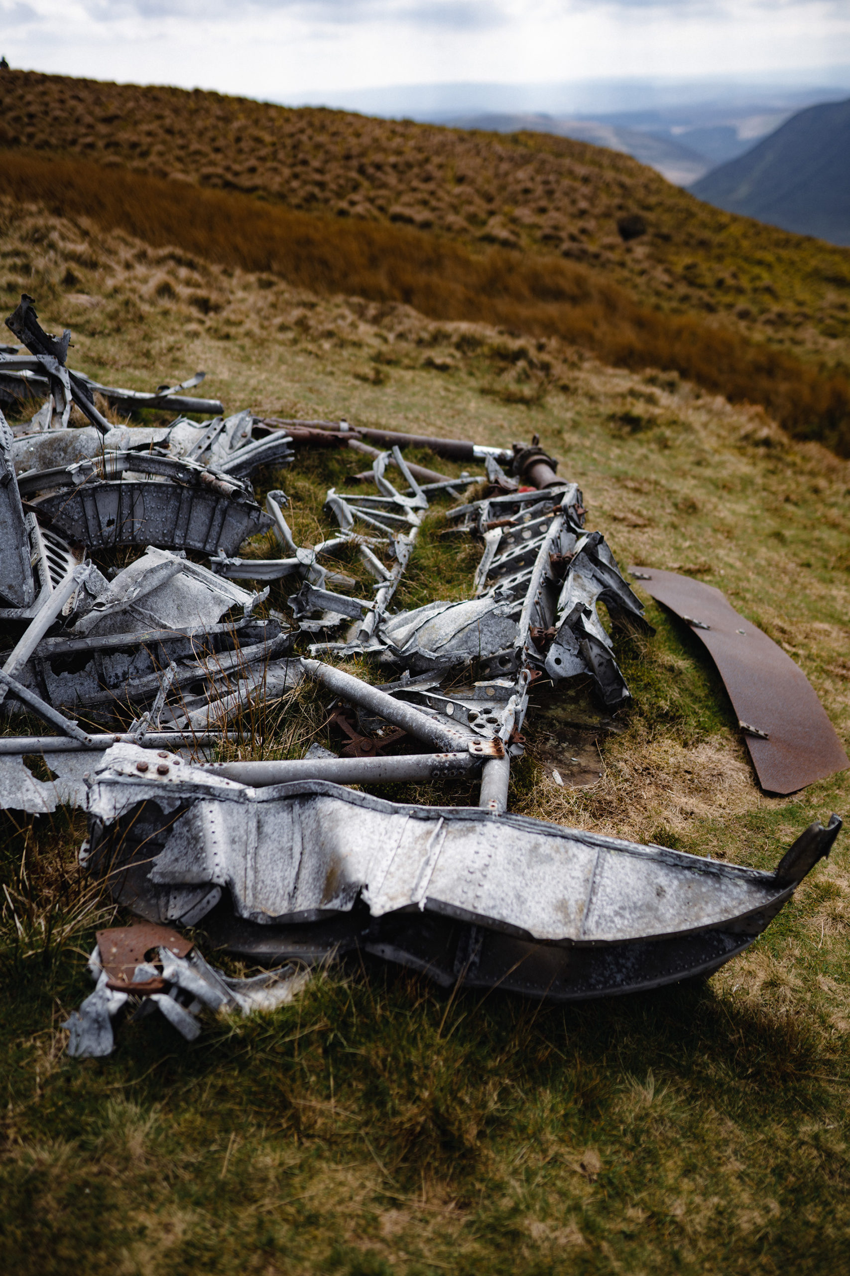
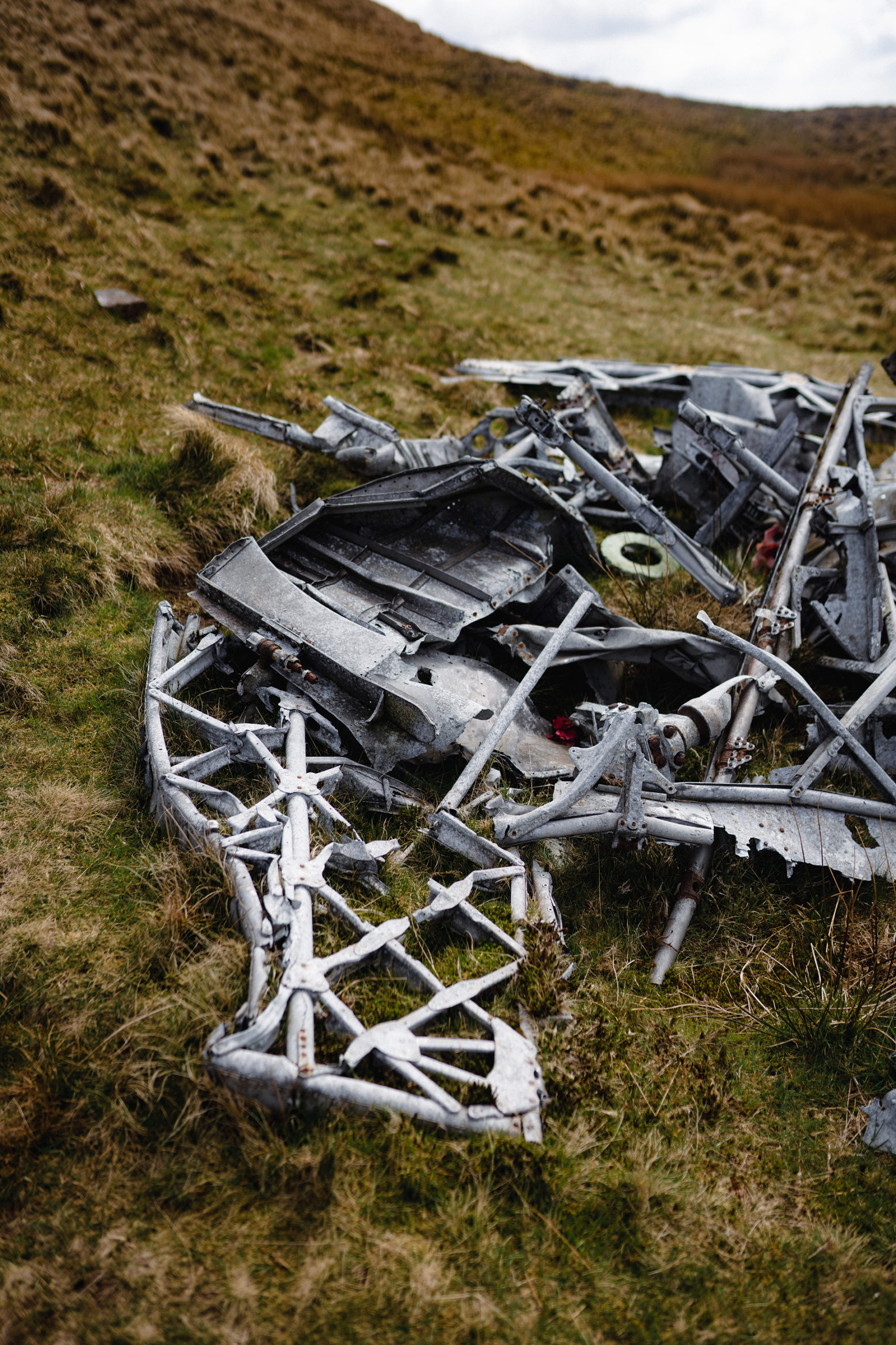
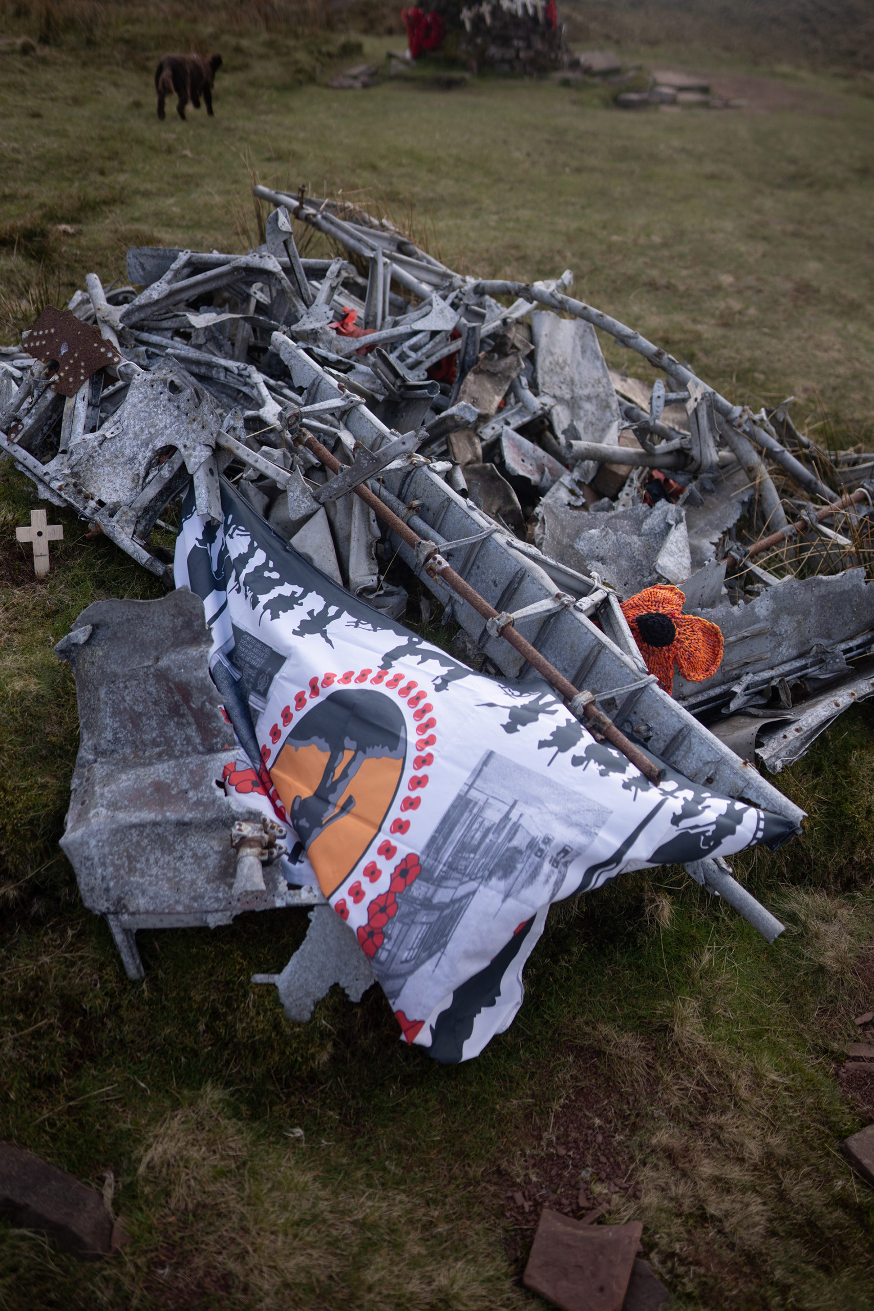
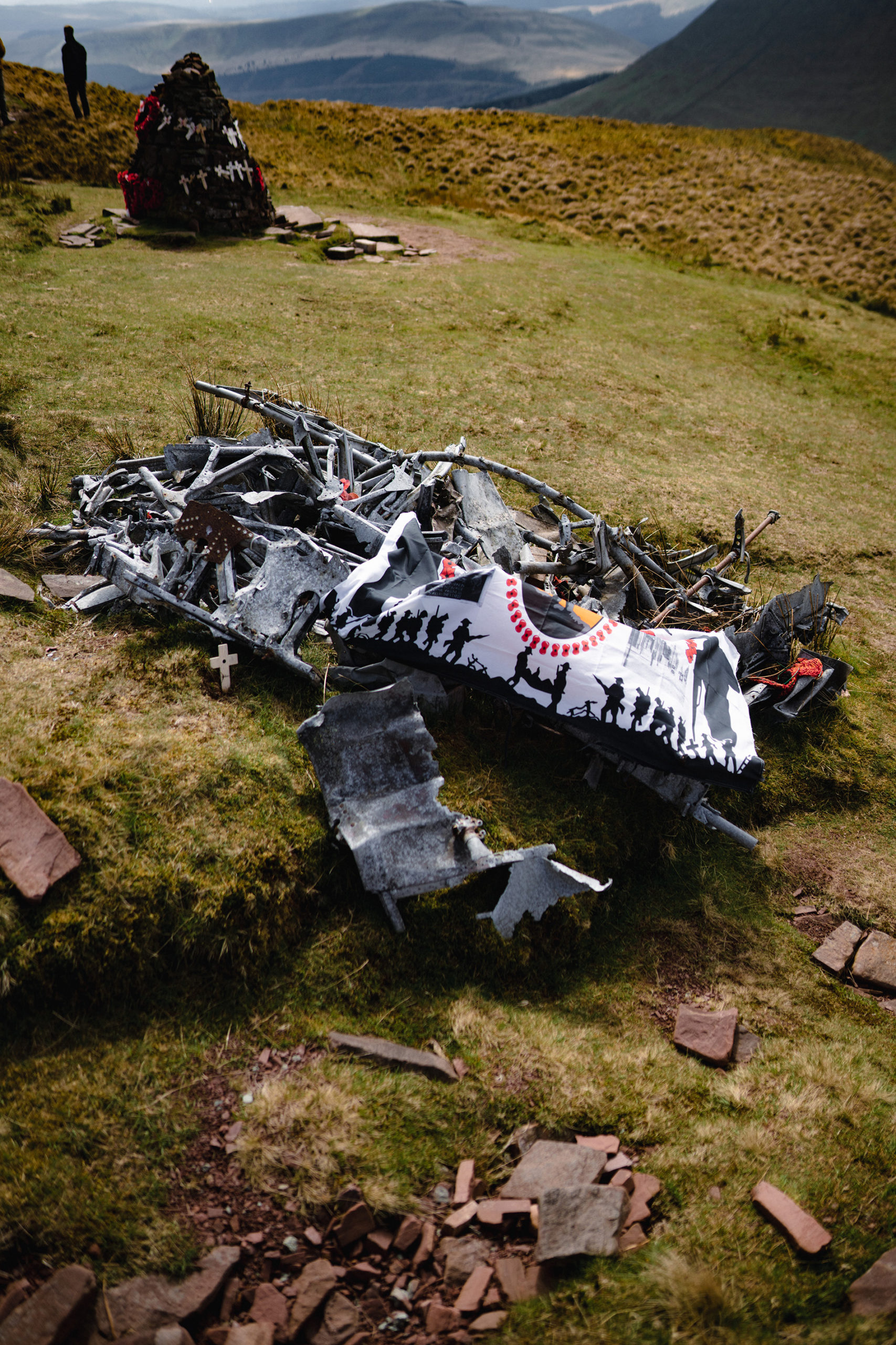
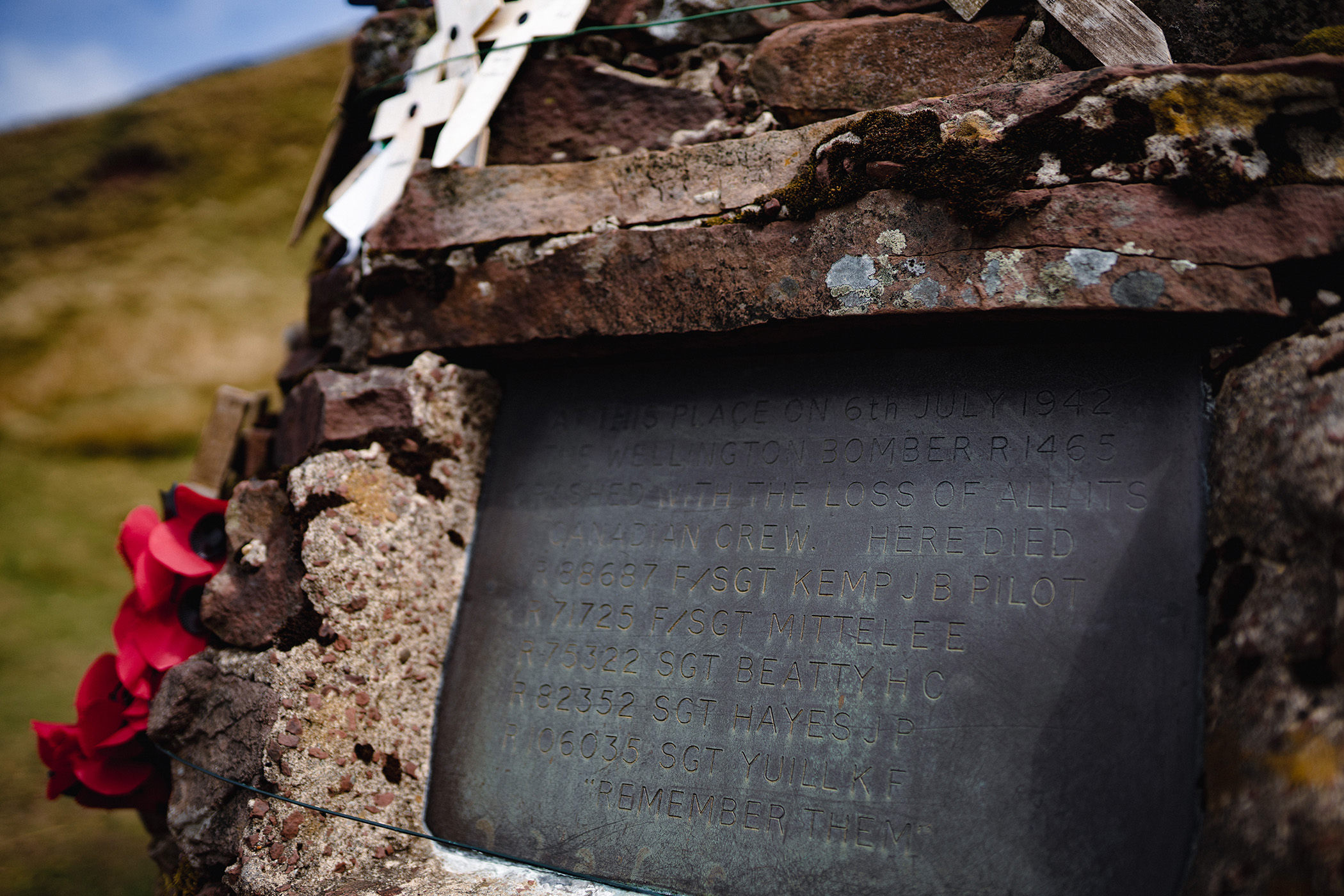
The site is located deep on the hillside the mountain called Waun Rydd. On July 6, 1942 the Wellington Bomber was completing a training mission when it crashed into the side of the mountain, killing all 5 Canadian crew members and spreading out debris across the mountainside. At the crash site there is a large stone memorial plaque, covered in poppies, crosses and wreaths. I spotted quite a few small canadian flags dotted around both the monument and the twisted metal of the plane.
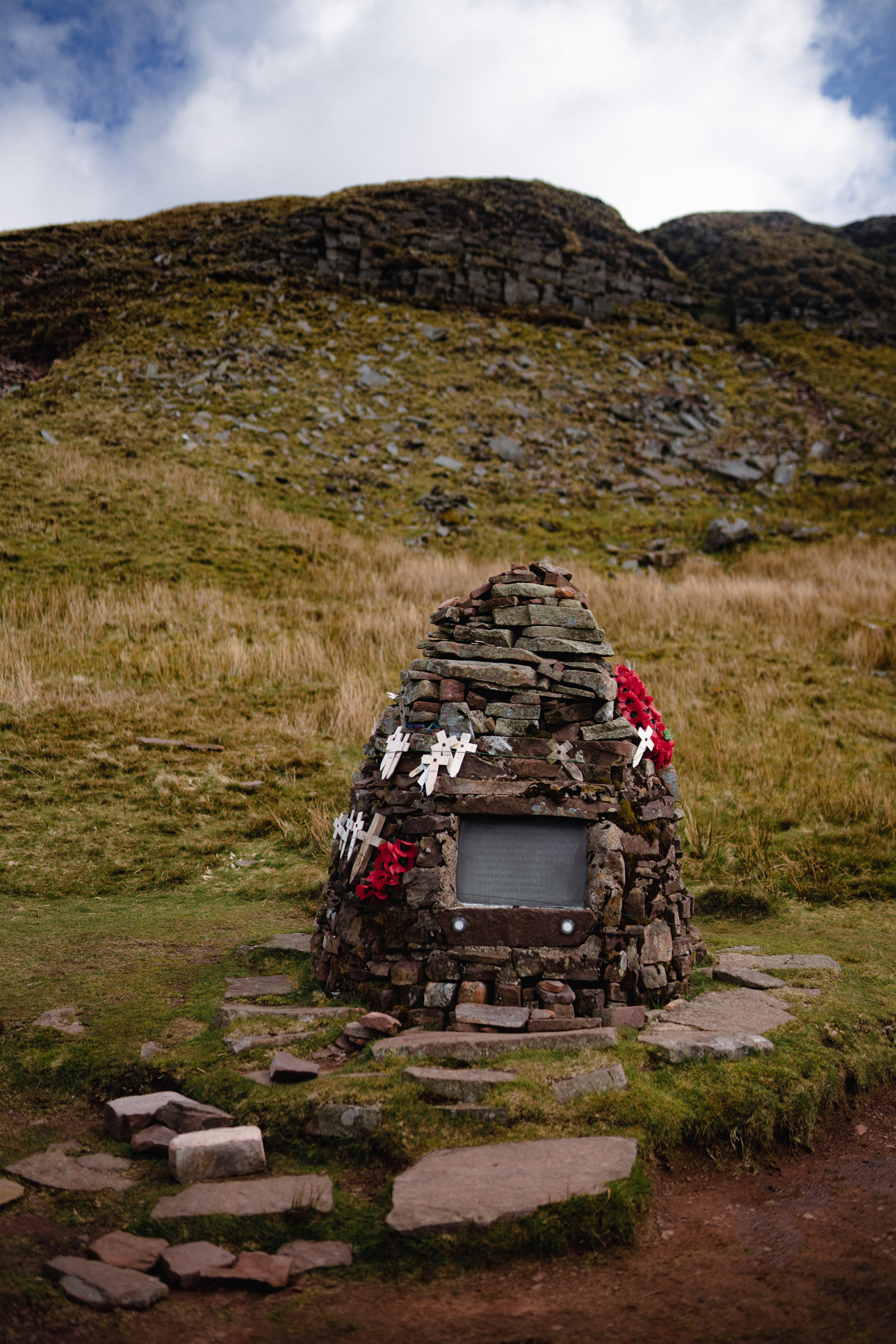
After visiting the memorial and also finding a smaller memorial buried nearby, honoring Welsh service members who had died, we continued along our descent from the mountain, heading back down to the Talybont Forest.
Our walk led us along the valley floor, through some farmer’s fields and then we followed a series of sheep trails, old stone roads, and a gravel road that gradually brought us back to our starting point. A 13.5km walk through the beautiful Brecon Beacons complete.